Google Street View Data
Street Air is pleased to announce that Google has given Street Air access to is extensive air pollution database. This data is collected on their Street View cars and then stored for later evaluation. Street Air is mapping the data and evaluating NOX, PM 1 and PM 2.5 data hot spots for futher study. Street Air’s goal is to determine how the hot spot is being created, if there are any possible mitigations, and the extent of the geographic boundaries of the hot spot.
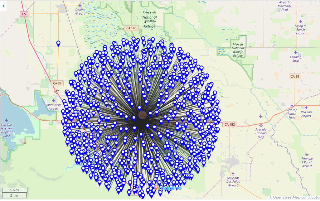
This is map is made from Google's Street View data. The data at this location represents 700 of the top 1000 PM 2.5 readings in the Street View database. Notice that the points located in a small geographic area in Los Bano's. We have done some preliminary that indicates that this PM 2.5 particulate is coming from a nearby CalTran's facility. Street Air is organizing a field trip to take PM 2.5 measurements in the area to do further research on this issue.
San Francisco Department of Public Health DRAFT 2020 Neighborhood Data
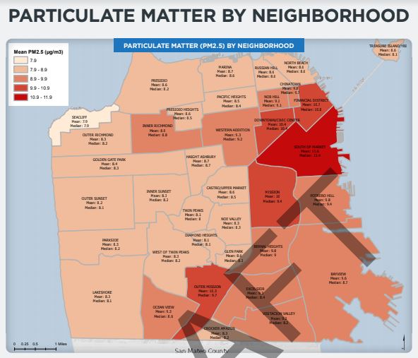
City of San Francisco Department of Public Health Draft PM 2.5 data. Street Air is researching areas >9.9 mean PM 2.5. February 2020.
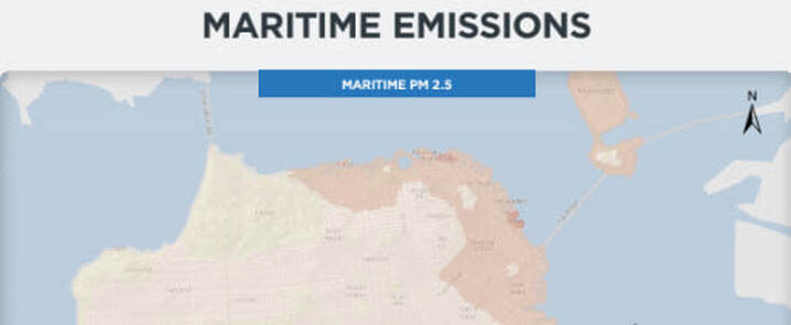
This is a new map (2020) from the San Francisco Department of Health. This shows the increase of maritime PM 2.5 along the waterfront, the Embarcadero, and along the Bay Bridge).
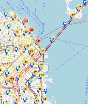 This is from Google Street View data. It shows the top PM 2.5 locations in the City of San Francisco. Notice the high concentration areas highest are (orange dots) along the water front and Embarcadero This is from Google Street View data. It shows the top PM 2.5 locations in the City of San Francisco. Notice the high concentration areas highest are (orange dots) along the water front and Embarcadero
|
Compare the map above with the map on the left and it is clear that there are maritime PM 2.5 impacts to the San Francisco waterfront. The map on the left shows a few common ferry routes and they seem to travel along the Embarcadero where the PM 2.5 rate is highest. Additional impacts will come to the same areas from the freeways and other high traffic areas. Draft aggregate maps are showing a higher level of red sites than just the maritime impact maps due to the dual impacts of maritime and freeway emissions. |